The call came in at 03:17 AM: a confirmed structure fire at the historic Fulton Bag and Cotton Mills complex in Cabbagetown, Atlanta. For Captain Eva Rostova of Atlanta Fire Rescue Department (AFRD), that’s an instant red flag. You’re not just fighting a fire in those old brick buildings. You’re fighting the maze-like layout and the risk of rapid spread. With reports of possible squatters, her first thoughts were victim location and structural integrity. The standard playbook meant sending crews in blind, risking lives in a totally unknown environment. What if there was a way to get eyes inside, safely and quickly, before committing personnel? That exact problem is what’s pushing advanced drone integration and smart mobile app development to the front lines.
Key Takeaways
- Incident commanders need custom mobile applications that deliver real-time drone telemetry and video feeds, and agencies have to make building them a priority.
- Solid drone integration depends on secure data transmission protocols that work even when local networks are shot.
- First responder training has to evolve to cover advanced drone piloting, how to read the data, and field maintenance for emergency situations.
- Using standardized communication APIs is the only way to get different drone platforms and existing emergency management software to talk to each other.
- Agencies need to be buying drones with thermal imaging, gas sensors, and high-def optical zoom to get a complete picture of the scene.
Captain Rostova had been a big backer of AFRD’s new drone program. Just six months earlier, she’d watched over the pilot deployment of two DJI Matrice 300 RTK units, picked specifically for their flight time and what they could carry. The real breakthrough was the custom mobile interface her team helped design. This wasn’t some off-the-shelf app. It was a purpose-built application, in development for 18 months, that let incident commanders deploy, control, and see critical data from the drones right on their tablets or in their command vehicles. It had the potential to be a very big deal.
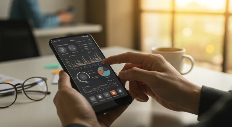
When the first engine company arrived, they radioed in heavy smoke and flames visible from the third floor of Building 10. Rostova, already on her way, got on the radio and told her drone operator, Specialist David Chen, to get ready for launch the second they hit the scene. Chen, a former commercial drone pilot with a software background, was a key part of making the mobile app work, he understood both flying the things and making the software usable. The app which they were calling “Sky-Eyes,” had a clean, simple interface. It showed a live map overlay with the drone’s position, its flight path, battery life, and the all-important HD video feed with thermal imaging. A Public Safety Drone Institute report found that agencies using dedicated mobile command apps for their drones cut down their initial scene assessment time by 30% on average.
As soon as they arrived, Chen launched the Matrice 300 from a safe spot. Rostova, glued to the feed on her ruggedized tablet, guided the drone’s first pass. The thermal camera immediately lit up with major heat signatures in the northeast corner of the building. Even more telling, it found several faint, unmoving heat signatures on the second floor, right below the fire. Potential victims. Without that eye in the sky, those people could have easily been missed in the chaos, or worse, crews would have gone into a crumbling structure without any idea where to start looking.
Building a specialized mobile app like this is a huge undertaking. You need to really understand a bunch of complicated fields: FAA rules, secure data transfer, real-time video processing, and the very specific needs of first responders on a scene. We’ve seen a lot of agencies try to repurpose commercial drone apps, and while you get some basic functions, you hit the wall pretty fast. Commercial apps don’t have the security, the right map overlays, or the hooks into existing Computer-Aided Dispatch (CAD) systems that a public safety operation has to have. The “Sky-Eyes” app, for example, had a direct API connection to AFRD’s CAD, so it could pull incident details, hazmat info, and building schematics right into the drone operator’s view. This meant Chen wasn’t flipping between different screens. He had all the info in one place.
One of the biggest headaches in mobile app development for drones is just keeping a solid connection in a terrible environment. Fire scenes, disaster zones, or remote search and rescue ops almost always have spotty or nonexistent cell service. “Sky-Eyes” got around this with a layered communication plan. It would first try to use direct Wi-Fi and radio frequency (RF) links between the drone and the ground controller, using cellular only as a backup to send data back to the main command post. Critically, it had an offline mode for maps and flight planning, so you could set up a mission even with zero network. That kind of redundancy is an operational imperative. A 2023 study from the National Institute of Standards and Technology (NIST) pointed out that network stability is one of the top three problems for public safety drone programs.
As the drone kept flying its pattern, Rostova had it use its optical zoom camera to peer into specific windows. The high-def feed showed people, looking dazed, near a stairwell on the second floor. She relayed the exact spot to Battalion Chief Miller, who was getting his entry teams ready. “Second floor, northeast stairwell, two individuals, conscious but possibly smoke-affected,” she yelled into her radio. Getting that kind of specific intel in just a few minutes would have taken much longer and put firefighters in more danger using traditional search methods. It was a remote, airborne extension of the incident commander’s own senses.
You can’t just brush past the user interface design for an app like this. First responders are working under incredible stress, so the app has to be dead simple to use with almost no thinking. Buttons have to be huge, clearly marked, and work even if you’re wearing gloves. Things like battery life and signal strength need to be right there in your face. During the “Sky-Eyes” project, the dev team spent weeks just hanging out with AFRD crews, watching how they worked and getting feedback. That cycle of testing prototypes in realistic scenarios and then refining them made all the difference. An early version had way too many sub-menus and was basically useless in a simulated high-stress drill. Cutting the navigation down to a few main screens fixed everything. It’s a lesson we’ve learned over and over in specialized mobile app design: the user’s context is everything.
Another major piece of drone integration that good mobile software enables is data logging for after-action review. Every flight, every picture, every single telemetry point from that Matrice 300 got logged by the “Sky-Eyes” app and then securely uploaded to AFRD’s cloud storage once a good network connection was available. This data is gold for debriefs, training, and even for legal documentation. For instance, you could go back and see the exact time a heat signature appeared or the precise moment a wall started to look unstable. That level of forensic detail was just not possible before. The future of emergency response is about continuous improvement driven by data.
The fire at Fulton Bag and Cotton Mills was, in the end, brought under control. The two people on the second floor were rescued, and a big reason for that was the pinpoint location data from the drone. Captain Rostova said it best during a debrief later that week. “Before this app, before these drones, we would have been guessing,” she said. “Sending crews into a building like that, with so many unknowns, is always a calculated risk. ‘Sky-Eyes’ let us remove some of the guesswork. It gave us eyes where we couldn’t send boots yet.” Public safety agencies adopting similar tech are all saying the same thing. A white paper from the International Association of Fire Chiefs (IAFC) on drone use confirms that the ability to do fast, remote reconnaissance dramatically improves firefighter safety.
Getting a system like this from an idea to something you can use on a call is a complicated journey. It takes serious technical skill in mobile app development and drone tech, but it also requires a tight partnership between the tech people and the first responders. You have to know the regulatory environment inside and out, especially the FAA rules for flying drones in controlled airspace and over people. Getting the right waivers and certificates of authorization (COAs) is a constant job. And you can’t skimp on training for your operators and incident commanders. The tech is only as good as the person using it. Regular drills and constant software updates are what keep the system working effectively. The upfront investment in a custom app like “Sky-Eyes” pays off in saved lives and smoother operations. It’s an essential tool for any modern emergency service.
Putting together a solid mobile app development strategy for drone integration is a necessity right now, not some idea for the future. Agencies have to start building secure, intuitive, and tough platforms that feed real-time intelligence to first responders, which in turn makes them safer and more effective when things go wrong.
What are the primary benefits of integrating drones with mobile apps for first responders?
The main upsides are a massive boost in situational awareness from real-time video and thermal feeds, the ability to quickly assess a scene for hazards and victims, better safety for responders because they aren’t going in blind, and smarter allocation of resources based on live data. Custom mobile apps pull all this control and data together so you can actually use it.
What technical challenges are involved in developing mobile apps for drone integration in emergency services?
The big technical problems are ensuring a secure data link in places with bad cell service, processing and showing HD video and sensor data with no lag, getting the app to talk to existing CAD and emergency management systems, and designing a user interface that’s easy to use when you’re under extreme stress. Managing battery life and different payloads from within the app is also tricky.
How does mobile app development address connectivity issues in emergency zones?
Good mobile apps tackle bad connectivity by using several layers of communication. They’ll prioritize direct Wi-Fi and RF links between the drone and the controller, using cellular only as a backup. They also have offline modes for planning missions and logging data so you can still operate without a network. Data is often cached and uploaded later when a connection is found.
What types of drones are typically used by first responders and how do mobile apps enhance their capabilities?
First responders generally use enterprise-level drones like the DJI Matrice or Autel Evo series, or even tethered drones, because they are reliable, can carry different payloads, and fly for a long time. Mobile apps make these drones far more useful by giving a single point of control for complex flight paths, managing sensors (thermal, zoom, gas), and overlaying critical data right onto the video feed, turning the drone into a true part of the command system.
What kind of training is required for first responders to effectively use drone-integrated mobile applications?
Training needs to cover more than just basic flying. Responders need advanced skills in drone piloting, including manual control and automated missions, plus how to interpret data from thermal, optical, and gas sensors. They also have to be experts in the mobile app itself, knowing the map overlays, data sharing features, and what to do in an emergency. Constant drills based on real scenarios and staying up-to-date on software and rule changes are absolutely necessary to stay sharp.
“Ring, the Amazon-owned home security company, is launching its own robotics division, with an eye toward automating security at both the home and the office.”