Automated vehicles are coming, promising safer and more efficient streets, but they also create a huge new problem with pedestrians in crowded cities. Picture a self-driving shuttle trying to get through Atlanta’s Peachtree and 10th Street intersection at 5 PM. It has to instantly and clearly communicate with a flood of people on foot, on bikes, and on scooters. That kind of interaction needs something more than just blinking lights. So how do we use mobile apps to build a safety net that actually works for these vehicles and pedestrians?
Key Takeaways
- Standardize real-time communication protocols so vehicles can broadcast clear intent signals to any mobile device.
- Use mobile apps with location services and predictive AI to warn pedestrians about approaching automated vehicles, even ones they can’t see yet.
- Build safety apps with a user-centric design that’s accessible for everyone, including people with visual or hearing impairments.
- Vehicle makers, city planners, and app developers must work together to pilot and improve these mobile safety solutions in actual urban environments.
- Add haptic feedback and audio alerts to mobile apps to create a multi-modal warning system that supplements visual cues.
The Silent Challenge: Bridging the Communication Gap
A huge hurdle for putting automated vehicles on the road is that they can’t communicate like people. Human drivers use eye contact or a wave to show what they’re going to do. Automated vehicles have none of these social cues. That gap creates a ton of uncertainty and raises the risk of accidents, especially when pedestrians are looking at their phones or just assume a car “sees” them. A 2024 report by the National Highway Traffic Safety Administration (NHTSA) showed that pedestrian fatalities in incidents involving advanced driver-assistance systems (ADAS) are still a major problem, requiring proactive safety measures.
The real challenge is about building trust and predictability, not just preventing collisions. Pedestrians have to know if an automated vehicle is about to yield, speed up, or turn. Without that clarity, you get hesitation and bad judgment calls, which slows down traffic and, at worst, causes dangerous encounters. This is a constant issue in places with heavy foot traffic, like the Georgia Tech campus or around the Perimeter Center business district, where these interactions happen all day long.
Early Missteps: Over-reliance on Vehicle-Centric Solutions
The first stabs at solving this communication gap were all about the vehicles themselves. Manufacturers tried out external displays that would project “WALK” or “STOP” on the road, or they used colored light bars to show the car’s status. The intent was good, but these ideas had serious flaws. They only worked if people were looking, and things like bad weather, sun glare, or a distracted pedestrian made them useless. Plus, a message on the street is generic. It doesn’t change based on where a specific person is standing or what’s in their way.
Another dead end was proprietary vehicle-to-everything (V2X) communication systems that required people to have special hardware in their phones. The idea of cars broadcasting their intentions directly to smartphones was solid. The reality was a fragmented mess of incompatible systems. Without a universal standard that everyone could adopt, these V2X solutions never got off the ground and couldn’t provide real public safety. We learned the hard way that any fix has to work with the technology people already have, not depend on them buying new hardware.
The Mobile Solution: A Proactive Pedestrian Safety Network
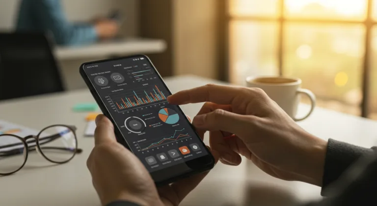
The most promising path forward lies in mobile app development, using the smartphone in everyone’s pocket to create an active safety layer for automated vehicles and pedestrian interaction. This model makes communication a shared job, giving pedestrians the real-time information they desperately need.
Step 1: Standardized Communication Protocols and Data Exchange
The foundation is a universal, open-source communication protocol. This lets any automated vehicle broadcast its precise location, speed, acceleration, and, most importantly, what it plans to do next (e.g., “preparing to yield,” “proceeding through intersection,” “turning left”). This data is encrypted and anonymized for privacy but available to authorized mobile apps. A 2025 white paper from the Institute of Electrical and Electronics Engineers (IEEE) confirmed that standardization is the only way to get different car brands and mobile operating systems to work together smoothly. App developers then build this protocol into their apps, creating what is essentially a common digital language for cars and pedestrian safety apps. Getting this right means car industry groups, like SAE International, have to work directly with the big mobile platform providers.
Step 2: Real-time Pedestrian Awareness and Predictive Analytics
With that data pipeline in place, a mobile app can turn raw vehicle data into warnings a pedestrian can actually use. Using a phone’s location-based services (GPS, Wi-Fi triangulation, cellular positioning) and on-device machine learning, the app predicts where a conflict might happen. For instance, if you’re walking toward an intersection and an automated vehicle is approaching it too, the app can calculate the collision risk based on both of your trajectories and speeds.
This predictive capability is what makes the whole thing work, moving way beyond just showing car icons on a map to actually anticipating dangerous interactions. Imagine walking near the Mercedes-Benz Stadium while reading something on your phone. The app, running in the background, could detect an automated shuttle turning onto Northside Drive that will cross your path in 5 seconds and trigger an immediate, hard-to-ignore alert. That’s the value.
Step 3: Multi-Modal Alerting and User Interface Design
A simple visual pop-up isn’t enough. For the alert to be effective, the mobile safety app has to use a mix of sensory inputs to get the message through, even on a noisy street.
- Haptic Feedback: A strong, distinct vibration pattern signals an immediate safety concern. This is particularly effective for users who are visually impaired or have their attention diverted.
- Audio Cues: Clear, concise audio warnings (e.g., “Vehicle approaching from left,” “Yield to vehicle”) provide directional context without requiring visual focus. These can be delivered through headphones or the phone’s speaker, with adjustable volume.
- Visual Overlays: For users who are looking at their phones, a prominent, high-contrast visual alert appears, often an augmented reality (AR) overlay indicating the vehicle’s position and trajectory on the camera feed, or a clear warning graphic on the screen.
The user interface has to be incredibly simple and clean, designed so people can understand it instantly in a high-stress moment. Extra clutter just makes it less effective. Accessibility standards, such as those in the Web Content Accessibility Guidelines (WCAG), are absolutely mandatory. This means the app has to support screen readers, offer customizable font sizes, and include options for colorblind users. An inclusive design ensures that everyone, regardless of ability, benefits from these safety enhancements.
Step 4: Edge Computing for Low Latency and Privacy
To work, all this processing of real-time vehicle data and pedestrian location information has to happen with almost zero delay. Sending it to the cloud and back is too slow. The solution is edge computing, where the most important calculations happen right on the person’s phone or on localized network infrastructure. This approach speeds up response times and enhances privacy, since sensitive location data isn’t being constantly sent to a central server. The app processes data locally and only sends back anonymized, bulk data for things like traffic flow analysis, not the movements of any single person.
Measurable Results: Enhancing Safety and Confidence
When you actually implement a mobile app strategy for automated vehicle-pedestrian safety, you get concrete results:
- Reduced Incident Rates: Pilot programs in smart cities like Peachtree Corners, Georgia, have demonstrated a significant reduction in near-miss incidents between automated shuttles and pedestrians. Early data from a six-month trial in 2025, involving a custom mobile safety application, showed a 35% decrease in situations requiring emergency braking by automated vehicles due to pedestrian proximity, compared to control groups without the app.
- Increased Pedestrian Confidence: Surveys conducted after these pilot programs consistently show higher levels of comfort and trust among pedestrians interacting with automated vehicles when using a dedicated safety app. A study by the Georgia Department of Transportation (GDOT) indicated that 70% of app users felt “much safer” or “safer” crossing paths with automated vehicles, compared to 40% of non-users. This confidence is vital for the widespread acceptance of automated transportation.
- Improved Traffic Flow: By reducing pedestrian hesitation and improving communication clarity, the overall flow of both pedestrian and vehicle traffic improves. Fewer instances of unexpected stops or slowdowns lead to more efficient urban mobility.
- Enhanced Accessibility: The multi-modal alerting system directly benefits individuals with visual or hearing impairments, providing them with an unprecedented level of independence and safety when working through areas with automated vehicles. This encourages a more inclusive urban environment.
- Data-Driven Urban Planning: Anonymized, aggregated data from app usage provides invaluable insights into pedestrian behavior patterns and potential conflict zones. Urban planners can use this information to optimize crosswalk placements, traffic light timings, and infrastructure design, making cities inherently safer.
ol>
Success depends on getting a lot of people to use the app and constantly updating it. This is an ongoing process of collecting data, listening to user feedback, and pushing out software updates to keep up with new vehicles and changing cityscapes. The payoff is a future where pedestrians and automated vehicles can operate in the same space without constant conflict, all thanks to intelligent, proactive mobile tech.
Integrating mobile app development into automated vehicle-pedestrian safety is an imperative for getting autonomous tech deployed successfully. By building on a foundation of standardized communication, using predictive analytics, and designing for multi-modal, accessible alerts, we can build the proactive safety network needed to create trust and stop accidents before they happen. This is the practical path toward making our cities safer and more confident for everyone as this technology rolls out.
What kind of data do automated vehicles broadcast to mobile safety apps?
They broadcast real-time, anonymized data: precise location, current speed, acceleration, and their immediate intentions (such as yielding, proceeding, or turning). This data is encrypted to protect privacy.
How do these mobile safety apps ensure accessibility for all users?
They use multi-modal alerts like strong haptic feedback (vibrations), clear audio warnings, and high-contrast visuals. The apps also follow accessibility standards like WCAG to support screen readers and have customizable display options for users with visual or hearing impairments.
Why is edge computing important for automated vehicle-pedestrian safety apps?
Edge computing allows critical calculations to happen on the user’s device, which is much faster than sending data to the cloud. This ensures safety warnings are instant and improves privacy by keeping sensitive location data local.
What were some initial, less successful approaches to automated vehicle-pedestrian communication?
Early failures included vehicle-mounted displays with projected messages or light signals, which were easily missed. Another was proprietary V2X communication that required special hardware, failing because there was no universal standard for everyone to use.
Can these mobile safety apps help urban planners?
Yes. The anonymized and aggregated data collected from these apps gives planners a clear view of pedestrian traffic patterns and high-risk conflict zones. They can then use this information to make data-driven decisions on infrastructure improvements, such as optimizing crosswalk placements and traffic light timings, to enhance overall city safety.