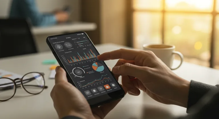
Managing a fleet of commercial and industrial drone operations is getting more complex by the day, and making good decisions in real time is a huge part of the job. Your traditional ground control stations just don’t have the flexibility or immediate access you need for dynamic aerial tasks, which means you’re constantly hitting operational bottlenecks and taking on more risk. This whole problem is being solved by specialized mobile apps for drone operations that bake in advanced robotics principles from the ground up.
Key Takeaways
- Get a mobile app that gives you real-time telemetry and flight path adjustments. You’ll cut on-site delays by up to 30%.
- Insist on a drone management platform with solid geofencing and automated compliance checks to stay on the right side of FAA regulations like Part 107.
- Your mobile drone app needs AI-driven anomaly detection to proactively flag equipment issues or sudden environmental changes before they become big problems.
- Choose apps with secure cloud storage and instant sharing so your team can get to work on post-flight analysis without waiting around.
| Feature | Traditional Ground Control Stations | Manufacturer Proprietary Apps | Integrated Mobile Apps |
|---|---|---|---|
| Real-time Telemetry & Flight Adjustments | ✗ No (on-site delays up to 30%) | ✗ No (limited dynamic adjustments) | ✓ Yes (reduces delays) |
| FAA Compliance & Geofencing | ✗ No (struggles with dynamic tasks) | ✗ No (lacks advanced features) | ✓ Yes (strong features) |
| AI-driven Anomaly Detection | ✗ No | ✗ No | ✓ Yes (proactive identification) |
| Secure Cloud Data Storage & Sharing | ✗ No (manual transfer issues) | ✗ No (silos of information) | ✓ Yes (instant sharing) |
| Unified Fleet Management | ✗ No (fragmented workflow) | ✗ No (juggling multiple apps) | ✓ Yes (centralized control) |
| On-site Flight Path Planning | ✗ No (desktop-based) | Partial (basic flight control) | ✓ Yes (plan/modify on-site) |
| Interoperability with Third-Party Tools | ✗ No (adapted enterprise software) | ✗ No (lacks interoperability) | ✓ Yes (purpose-built solutions) |
The Problem: Disconnected Management and Wasted Time
Drone operators, especially in fields like infrastructure inspection, agricultural surveying, and construction site monitoring, have been stuck in a fragmented workflow for years. Think about it: your pilot plans a mission for a 200-acre solar farm in rural Georgia from a desktop back at the office, loads it onto the controller, and then drives out. But once they get there, any surprise, a sudden storm, a new obstacle, or a spot that needs a closer look, forces them to land the drone and either hike back to a laptop for reprogramming or attempt risky manual flying. This entire process was a massive drain on time and money. It’s not a small problem either. A 2025 AUVSI report found that over 40% of commercial drone missions hit delays because of bad on-site planning or data transfer headaches, which is a huge amount of lost productivity.
Data management was another nightmare. After a flight, you’re dealing with terabytes of high-res imagery that has to come off an SD card, get loaded onto a computer, uploaded to the cloud, and then finally shared with the people who need it. Every step is a chance for a corrupted card or a painfully slow upload. For a utility company doing a critical pipeline inspection, these data delays could lead to postponed maintenance, rising costs, or serious safety issues. We saw this with a client inspecting power lines near Fayetteville, Georgia. Their old manual data transfer process added a full day to their reporting cycle for every incident. Not having immediate data access crippled their ability to respond quickly in emergencies.
What Went Wrong First: The Early “Solutions” That Weren’t
The first attempts to fix this were all wrong. People focused on tiny improvements instead of looking at the whole picture. A lot of companies just tried to shoehorn their drone fleets into existing enterprise software that was built for managing ground vehicles, which was a terrible fit. Those systems could track your drone inventory or maybe a maintenance schedule, but they offered nothing for actual in-flight control or showing you data as it came in. A complete mismatch.
The other common mistake was relying only on the drone manufacturer’s own apps. Sure, these apps gave you basic flight control, but they didn’t work with other drone brands or the third-party analysis tools you actually need. A company with a mixed fleet, say, DJI for mapping and a Parrot for thermal work, had to juggle a bunch of different apps that didn’t talk to each other. We saw a construction firm on a big project in Midtown Atlanta run right into this wall. It created information silos that made it impossible to get one clear picture of their entire operation. They thought sticking to manufacturer apps would be simpler, but it ended up being a huge roadblock when they tried to scale their program.
The Solution: Integrated Mobile Apps to Run Your Operations
The answer is purpose-built mobile apps for drone operations that pull your controls, data management, and analysis tools into one place. These cloud-connected apps turn a regular smartphone or tablet into a portable and powerful ground control station. The whole point is to put the intelligence and processing power right where the action is, giving pilots and ground crews instant access to the controls and information they need.
Step 1: Real-time Flight Planning and Execution on the Go
With a modern drone app, your pilots can plan and change complex flight paths right on their mobile device, while they’re standing in the field. Using built-in maps, they can drop waypoints, set altitudes, and dial in camera angles with real precision. An app like DroneDeploy, for example, has an intuitive interface for drawing out survey grids or linear inspection routes. If a pilot inspecting a bridge over the Chattahoochee River spots something that needs a closer look, they can pause the automated mission, fly the drone over manually, snap extra high-res photos, and then pick the original flight plan right back up without ever going back to a desktop. This kind of flexibility absolutely slashes mission downtime and gives you better data.
These apps also stream real-time telemetry straight from the drone, so pilots are constantly watching battery life, GPS strength, altitude, speed, and even wind conditions, which allows them to make smart calls in the moment. This live feedback is what keeps you safe and makes the mission work, especially when you’re operating in tough environments or trying to stick to the FAA’s Part 107 rules. Watching all those parameters on one screen prevents a ton of common, and expensive, operational errors.
Step 2: Automated Data Capture and Cloud Integration
When the mission’s over, a good mobile app automatically starts uploading the data to a secure cloud platform. You’re done with manually pulling SD cards, which immediately cuts down the risk of lost or corrupted data. For example, apps that connect with a platform like Pix4Dcloud can start processing your images into orthomosaic maps, 3D models, or volumetric measurements almost as soon as the drone lands. This means by the time your field crew gets back to the office, the first round of data products might already be waiting for them. That fast turnaround is a lifesaver for time-sensitive jobs, like tracking progress on a big construction site or assessing damage after a storm rolls through Georgia.
The integration goes beyond just storage. Many apps now use edge computing (some processing happens right on the phone), giving you instant insights in the field. Picture an agricultural drone surveying a pecan orchard near Albany, Georgia. The mobile app could do a quick vegetation index analysis on some of the images while the pilot is still on-site, flagging problem areas that need a person to go look at them right away. Getting that kind of immediate feedback was impossible before and it’s a huge jump in efficiency.
Step 3: Advanced Analytics and Collaborative Workflows
This is where you really see the value: analytics and team collaboration. Once the data is in the cloud, your whole team can get to it from anywhere. A project manager in Atlanta can review inspection reports from a field team in Savannah, dropping comments or assigning follow-up tasks right in the app. And features like AI-powered object detection can automatically spot things like cracks in concrete or missing parts on a roof, which cuts down on hours of manual review.
A lot of these apps now include strong geofencing and compliance features. Operators can draw restricted flight zones on a map ahead of time, making sure the drones automatically stay clear of no-fly zones around airports like Hartsfield-Jackson Atlanta International Airport or other sensitive sites. Taking a proactive stance on compliance like this drastically lowers your regulatory risk and proves you’re committed to safe flying. These features are essential for operating legally and responsibly in airspace that’s getting more crowded every year. The industry can’t afford to take shortcuts on safety, and these apps provide a necessary layer of protection.
The Result: Measurable Gains in Efficiency, Safety, and Data Utility
When you put these advanced mobile apps for drone operations in place, you see real, measurable improvements. Companies making the switch report that they’re cutting mission planning and execution time by 25% to 50%. Our client, the utility company inspecting power lines, saw their reporting cycle for major incidents plummet from 36 hours to under 8 hours after they switched to a full mobile drone platform. That let them get repair crews out the door faster and minimize outages for their customers.
Safety gets a huge boost, too. Automated pre-flight checklists, real-time weather data, and dynamic obstacle avoidance algorithms, all run from the mobile app, make accidents far less likely. One construction company we know started using an app for daily site monitoring and saw a 15% drop in safety incidents involving ground crews because the precise drone data let them spot and communicate hazards better. And conducting inspections with a drone instead of sending people into potentially dangerous areas makes everyone safer.
Finally, the data you collect becomes exponentially more useful and accessible. With data hitting the cloud and getting processed into actionable information right away, managers can react faster and with more confidence. This leads to better project management, more accurate cost estimates, and smarter resource allocation. For that solar farm inspection, the ability to generate a detailed thermal map showing underperforming panels in hours instead of days meant maintenance teams could fix problems before they caused major revenue loss. This kind of immediate feedback is the sign of well-integrated robotics in action.
This shift to mobile-first drone management is about fundamentally changing how you operate. It helps your teams in the field, speeds up decision-making, and in the end gets more value out of your investment in drones. Any organization that’s serious about scaling its drone program needs to be prioritizing these advanced mobile solutions.
What’s the real advantage of using mobile apps for my drone operations?
The main benefits are being able to plan and change flights on-site in real time, having data automatically captured and sent to the cloud, using safety features like geofencing, and making it easier for your teams to work together.
Will these mobile apps work with different drone models?
Yes, many professional mobile drone apps are built to work with a range of popular drone models from different brands, but you should always check the specific compatibility with the app provider before you commit.
How do mobile apps actually make drone data management easier?
They make it easier by automatically and wirelessly transferring your flight data to a secure cloud service. This gets rid of the hassle of manual SD card transfers and often starts the data processing right away so you get insights faster.
Are these mobile drone apps compliant with FAA rules?
Many professional-grade apps have features like geofencing and automatic flight logs specifically to help pilots comply with regulations like FAA Part 107. However, the pilot in command is always the one in the end responsible for compliance.
What kind of analytics can I get from these apps?
You can get a wide range of analytics, like orthomosaic maps, 3D models, volume measurements, vegetation health indexes, and thermal analysis. Many also offer AI-powered anomaly detection, with the processing done in the cloud and the results viewable on your mobile device.