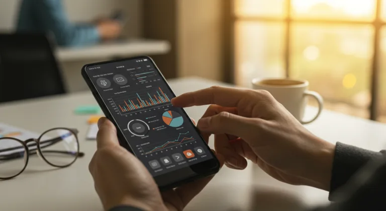
Spatial computing is finally leaving the lab and hitting the enterprise floor. We’re talking about integrating digital information directly with the physical world, and by 2026, it’s no longer a niche gimmick. Thanks to huge leaps in mobile device power and cloud infrastructure, sophisticated augmented reality (AR) and mixed reality (MR) are becoming practical tools for day-to-day business. This shift will completely change how field service teams, manufacturing facilities, and logistics operations interact with their environments and data. So, how do you actually get this powerful tech integrated into the mobile workflows you already have?
Key Takeaways
- Get a pilot program running within 90 days using an off-the-shelf AR SDK like ARCore or ARKit to build your initial proof-of-concept and generate some internal buzz.
- Prioritize mobile devices that have LiDAR scanners, like the latest iPhone Pro models or certain Android flagships, because you’ll need their superior environmental mapping for any serious spatial computing app.
- Build or integrate digital twin solutions that can pull data from your IoT sensors and ERP systems in real-time, which is the only way to ensure the data your team sees is accurate.
- Focus your first spatial computing deployments on use cases that have a very obvious ROI, such as remote assistance for equipment repair or interactive training, so you can justify further investment.
“Science Corp’s PRIMA implant has already restored eyesight in people with severe vision loss, using a pair of glasses with a tiny camera that beams a captured scene onto a chip implanted in the retina.”
1. Define Your Enterprise Spatial Computing Objectives
Before you even think about technology, you have to clearly state what you’re trying to accomplish with spatial computing on mobile. Saying you want to “improve efficiency” is useless. You need to identify specific operational problems. For example, a manufacturing plant could set a primary objective of reducing equipment downtime by 25%, which they believe is achievable through AR-guided maintenance procedures on the factory floor. A logistics company might aim for a 15% jump in warehouse picking accuracy by overlaying digital inventory data directly onto the view of physical shelves. Getting this right up front dictates every single technical and strategic choice you make later.
I always tell clients to conduct a thorough process audit. You need to map out your current workflows and find the exact points where getting information or physically interacting with something is a pain. Look for tasks that force people to check paper manuals, perform complicated visual inspections, or call a remote expert for help. These are your best candidates for a spatial computing solution. A major utility company we worked with in Georgia, for instance, discovered their field technicians were wasting an average of 45 minutes a day just cross-referencing schematics for underground infrastructure, a clear-cut opportunity for an AR overlay app.
Pro Tip: Start Small, Think Big
Don’t try to boil the ocean. Pick one or two high-impact but manageable use cases for your first deployment. A win on a smaller project creates internal champions and teaches you valuable lessons you’ll need when it’s time to scale up.
2. Select Your Mobile Hardware and Platform
Your hardware choice can make or break this. And not all smartphones are the same here. Modern devices that come with LiDAR scanners, like an iPhone 15 Pro or Samsung Galaxy S24 Ultra, give you massively better depth sensing and environmental understanding than phones that just use a camera and SLAM (Simultaneous Localization and Mapping). What that gets you is more stable AR, better object occlusion (so virtual things look like they’re actually behind real things), and much more accurate spatial anchoring of your digital content. It’s a big deal.
For development, if you need to support a mix of devices, you’ll be looking at the standard SDKs like Google ARCore for Android and Apple ARKit for iOS. These give you the basics for motion tracking, understanding the environment, and light estimation. To make life easier, a unified platform like Unity or Unreal Engine with their AR Foundation packages can handle development for both ecosystems at once. For really specialized industrial work you might look at dedicated AR headsets like the Microsoft HoloLens 2, but that’s a different beast than the broad mobile integration we’re focused on here.
Common Mistake: Underestimating Device Capabilities
If you try to run a complex spatial app on old, underpowered phones, you’ll just get laggy, frustrating experiences and bad tracking. The project will fail. Invest in the right hardware from the start.
3. Develop or Integrate Digital Twin Solutions
The real power of enterprise spatial computing comes when you connect it to digital twins. A digital twin is a live, virtual model of a physical thing, system, or process that’s constantly updated with data from sensors and other operational systems. For mobile spatial computing, this means your technician can look at a complex industrial pump through their phone and see its real-time pressure, temperature, and maintenance history overlaid directly on the physical equipment. That’s the goal.
Building out a solid digital twin infrastructure requires a few key pieces:
- Data Ingestion: You’ve got to pull data from your IoT sensors, SCADA systems, ERP platforms (like SAP S/4HANA), and maintenance management systems (IBM Maximo).
- Data Model: You need a standard data model for your assets. This often means using industry standards like OPC UA or leaning on cloud services like Azure Digital Twins or AWS IoT TwinMaker to get it done.
- Visualization Layer: This is where your mobile app plugs in. It grabs the right data from the digital twin and renders it in the user’s AR view, right where it belongs.
For a manufacturing plant we worked with near the Chattahoochee River, we built a system that let production supervisors see the real-time status of every machine, including throughput and error logs, just by pointing their tablet at it. It cut way down on time spent walking to control panels or checking separate dashboards.
4. Design User-Centric AR Experiences
Your app can be technically perfect, but it’s useless unless it’s genuinely intuitive and helpful for the person using it. When designing the augmented reality experience, you have to obsess over clarity, efficiency, and keeping the cognitive load low. This means a few things:
- Contextual Information: Don’t just vomit data onto the screen. Show only what’s relevant for the immediate task. Anything else is just noise.
- Intuitive Interactions: Use natural gestures that people already know, like tapping, pinching, and dragging. Voice commands can also be a lifesaver in jobs where both hands are busy.
- Clear Visual Cues: Use simple color coding, animations, and highlights to show what’s important. A red outline around a part that’s failing or a green arrow pointing to the next item to pick in a warehouse, keep it simple.
- Strong Anchoring: The digital content has to stick to the physical world and stay there as the user moves around. You’ll need persistent world anchors (sometimes using QR codes or other markers) or regular recalibration to keep things from drifting.
Think about a field technician needing to repair a complex HVAC unit. The AR app should walk them through it step-by-step, overlaying instructions, highlighting the specific valve to turn, and even letting them start a video call with a remote expert with a single tap, sharing their live AR view. The digital information should feel like part of the physical world, not a clunky layer on top of it.
Pro Tip: Test in Real-World Conditions
Lab testing is a joke for this kind of work. You have to get prototypes into the hands of real users in their actual work environments, with all the bad lighting, noise, and constant movement, to see if your design actually holds up.
5. Implement Strong Data Security and Privacy Measures
Spatial computing apps, especially when tied to digital twins, are swimming in sensitive data, operational stats, proprietary designs, sometimes even personal info. Security has to be baked in from day one.
- Data Encryption: Encrypt all data, period. In transit (TLS 1.3) and at rest (AES-256). No exceptions.
- Access Control: Use strict role-based access control (RBAC) so users only see the data and functions they’re supposed to. A junior tech shouldn’t be able to access critical system settings.
- Device Security: You need strong mobile device management (MDM) policies. That means forcing secure boot, using biometric authentication, and having the ability to remotely wipe any device that gets lost or stolen.
- Privacy by Design: If your app’s camera might capture people, you have to comply with privacy rules like GDPR or CCPA. Think about anonymization techniques if you can use them.
A breach in one of these systems could expose critical infrastructure weak points or trade secrets. For instance, an AR app used for inspecting the power grid needs to have ironclad security to keep people from accessing grid schematics or control functions. This is a fundamental requirement for getting any enterprise to adopt this stuff.
6. Plan for Scalability and Integration
Okay, your pilot worked. Now what? You need a clear plan to scale this thing up. That means making sure your architecture can handle more users, more data, and integrations with all your other enterprise systems.
- Cloud-Native Architecture: Design your backend on something that scales, like AWS, Azure, or Google Cloud. Serverless functions and managed databases are your friends here because they can adjust resources automatically.
- API-First Approach: Build everything with well-documented APIs. This is how you’ll easily connect your AR app and digital twin services to the ERP, CRM, and IoT platforms you already use. A good example is using RESTful APIs to push a maintenance alert from the AR app directly into a ServiceNow ticket.
- User Training and Support: As you roll this out to more people, you have to invest in real training programs and set up clear support channels for when things go wrong. Some companies even find it helpful to create an internal AR/VR center of excellence.
The real value of enterprise spatial computing comes from how well these apps integrate into the company’s wider digital infrastructure. For a company running multiple distribution centers across Georgia, for instance, a unified spatial computing platform that gives them consistent inventory management and picking guidance in every location, all tied into a central warehouse management system, is where the big win is.
Putting spatial computing on mobile in the enterprise isn’t a weekend project. It’s a strategic, phased rollout that starts with clear goals and ends with a secure, scalable deployment. If you get the hardware right, integrate with digital twins, focus on the user, and lock down security, you can create huge operational advantages and completely change how your mobile teams work. For more on just making sure your apps are built well, you might want to read up on mobile code quality best practices.
What is spatial computing in the context of mobile enterprise?
It’s using smartphones and tablets to put digital information, through augmented reality (AR) or mixed reality (MR), directly into a worker’s view of the physical world. This lets them interact with virtual data and objects that are anchored to real-world scenes to help with tasks like maintenance, training, and logistics.
What are the key benefits of using spatial computing in an enterprise setting?
The big wins are better operational efficiency from AR-guided workflows, fewer mistakes on complex jobs, easier remote collaboration with experts, more effective training programs, and the ability to see data in context for faster decision-making and less downtime.
Which mobile devices are best suited for enterprise spatial computing applications?
You really want devices with LiDAR scanners, like the newer iPhone Pro models or high-end Android phones such as the Samsung Galaxy S24 Ultra. Their advanced depth sensing and environmental understanding produce the stable and accurate AR experiences that are necessary for professional use cases.
How do digital twins relate to mobile spatial computing?
Digital twins often act as the real-time data source for mobile spatial computing apps. By connecting a virtual replica of a physical asset (the digital twin) to a mobile AR application, users can see live operational data and performance metrics overlaid directly onto the physical asset they’re looking at.
What are the primary security considerations for deploying spatial computing in the enterprise?
Top of the list is data encryption everywhere (in transit and at rest), strict role-based access control, solid mobile device management (MDM) policies, and building with privacy in mind from the start to comply with data regulations, especially since cameras are involved.