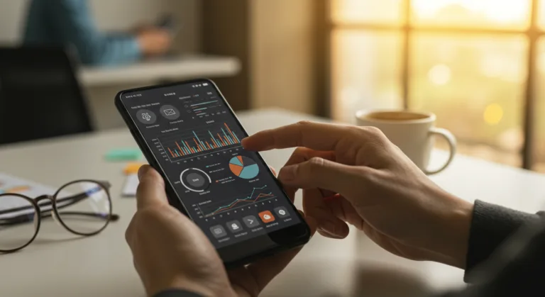
If you’re dealing with spatial computing, you’re probably drowning in data. The real bottleneck isn’t just getting the data, it’s turning that raw, real-time telemetry into something your team can actually act on. This means rendering dynamic information across complex 3D contexts, which directly affects how fast and how well your people make decisions. So, how do you get live data streams visualized inside your operational frameworks so you can actually get ahead?
Key Takeaways
- Build a real-time data pipeline that can actually ingest and process millions of spatial points per second from all your different sources.
- Use mobile dashboards built for spatial computing, making sure they render fast and feel intuitive when interacting with geo-located data on a phone or tablet.
- Focus on visualization tools with strong support for dynamic 3D mapping and overlays so you get immediate context on operational changes.
- Set aggressive performance benchmarks for latency, you should be aiming for sub-second data-to-display times for any critical dashboard.
- Bake advanced anomaly detection algorithms right into the visualization layer to automatically flag weird patterns in your spatial data.
| Factor | Traditional Dashboards (Misguided Approach) | Real-time Spatial Computing Dashboards (Solution) |
|---|---|---|
| Data Processing | Batch processing (5-10 minute updates) | Real-time pipeline (millions of points/second) |
| Data Latency Target | Delayed responses, several minutes lag | Sub-second data-to-display times |
| Visualization Type | Static maps, simple points/heatmaps | Dynamic 3D mapping, overlay capabilities |
| Mobile Experience | Stripped-down, less functional versions | Responsive rendering, intuitive interaction |
| Insight Generation | Stale insights, real-time correlation impossible | Immediate contextual understanding, anomaly detection |
| Scalability | System bottlenecks, crashes under data load | Architected for velocity and volume of spatial streams |
The Problem: Data Overload and Stale Insights in Spatial Operations
Think about running a logistics network in a dense urban area, with hundreds of vehicles, drones, and sensors all blasting out location, speed, and status data constantly. Your standard dashboards, the ones built for static quarterly reports, just can’t handle it. The firehose of data swamps your analysts which means they’re slow to react when a truck gets stuck in traffic or a piece of equipment fails. We’ve seen this up close with clients trying to integrate data from their IoT fleets. They knew the info was there, but it was trapped in different systems or shown in ways that made connecting the dots in real time impossible.
A classic pitfall is trying to use batch processing for spatial data. A system that updates every five or ten minutes looks fine on paper, but in a live operation, a five-minute delay means your delivery truck is already stuck in that accident you just found out about. A city utilities department monitoring underground pipes needs instant alerts on sensor readings to stop a failure, not a summary report from an hour ago. The problem gets worse when you start pulling in data from GPS trackers, environmental sensors, drone feeds, and even social media chatter about certain locations. Just trying to pull all those different feeds into one coherent and, most importantly, live visual is a massive technical challenge.
The data itself is another headache because it’s so complex. You’re dealing with a lot more than just X and Y coordinates. There’s elevation, time, and multiple data points from a single sensor (like temperature, humidity, and pressure all at once). Showing that effectively on a screen, especially a small mobile one, takes specialized visualization tools that most BI platforms just don’t have. Without them, your decision-makers are stuck staring at static maps or dense spreadsheets, completely missing the spatial relationships and timing that actually define what’s happening on the ground.
What Went Wrong First: Misguided Approaches to Spatial Data Visualization
Of course, our first instinct was to just adapt the enterprise dashboards we already had. We tried to force more data through old-school ETL processes and just refresh them faster, thinking it would work. It didn’t. This just created system bottlenecks, drove up infrastructure costs, and gave us dashboards that were either painfully slow or just crashed. The underlying database and visualization tools were never designed to handle the speed and sheer amount of data coming from real-time spatial streams.
For example, on one project tracking public transit, we first tried using a standard BI platform. The system choked trying to update hundreds of vehicle locations at once, creating a lag of several minutes. Operators were seeing buses “stuck” on their screens when they were moving just fine, which led to total confusion and bad dispatching decisions. The platform couldn’t render complex geo-spatial overlays dynamically, so we couldn’t integrate critical info like live traffic incidents from other feeds. The user experience was awful, just spinning loaders and old data. And any attempt to make these things work on mobile ended with a stripped-down, barely usable version that lost all the rich context needed to make a call on the go.
Relying too much on static map layers was another mistake we made. Base maps are fine, but just throwing dynamic data on top as simple dots or heatmaps without any interactive time controls isn’t enough. Analysts needed to be able to scrub back and forth through time, filter by vehicle type, or drill into a specific sensor reading, but those features were either missing or a pain to use. Because there was no true real-time data visualization, by the time someone spotted a problem, it had already gotten worse, defeating the whole point of monitoring in the first place.
The Solution: Architecting Real-time Spatial Computing Dashboards for Mobile
Fixing this takes work on multiple fronts, from a solid data ingestion pipeline all the way to purpose-built mobile dashboards. The core idea is to switch to an event-driven architecture, where you process and visualize data the moment it arrives instead of waiting for a batch. This is a fundamental change in how you approach operational intelligence.
1. Real-time Data Ingestion and Processing Pipeline
First, you have to build a pipeline that can handle the firehose of spatial data with low latency. We push for streaming platforms like Apache Kafka or Amazon Kinesis because they’re built to handle millions of events per second, grabbing GPS coordinates and sensor telemetry instantly. From there, you process the data in real-time with frameworks like Apache Flink or Apache Spark Streaming. This is where you run things like geo-fencing, anomaly detection, and data enrichment (like matching a vehicle ID to its maintenance record). The whole point is to turn that raw stream into structured, visualization-ready data, usually leaning on cloud services to scale.
For a fleet management system, this would look like GPS data from trucks streaming into Kafka. A Flink job would then process that stream, flagging trucks that enter a warehouse perimeter or deviate from their planned route. Because this happens in real time, alerts go out immediately. The processed, enriched data then gets pushed into a specialized spatial database like PostGIS or MongoDB Atlas for Geospatial that’s optimized for the fast queries you’ll need.
2. Dynamic Spatial Data Visualization Engine
Once the data is flowing, you need an engine that can actually render it well. This requires a visualization engine built for spatial data that can handle huge datasets and constant updates. We recommend frameworks like deck.gl or CesiumJS because they’re optimized for rendering massive numbers of geo-located points and polygons in both 2D and 3D. These engines let you layer all kinds of information, from vehicle paths to weather patterns, and they support interaction like zooming and filtering without bogging down. They also let you create custom visual layers to show complex data through color, size, and animation.
Imagine a public safety app monitoring emergency response. The viz engine would show active incidents as pulsing icons, colored by severity. Response vehicles would be moving arrows, with their color changing based on their status (en route, on scene). By overlaying real-time traffic from an API like the TomTom Traffic API, dispatchers can see potential delays and reroute units. Being able to switch between a 2D map and a 3D terrain view gives them a complete picture of the operational area, including challenges like hills or dense urban canyons.
3. Mobile-First Dashboard Design for Spatial Computing
The whole point is getting these insights to people in the field who can use them. That means designing mobile dashboards from scratch, not just shrinking the desktop version. Given the small screen, mobile spatial dashboards have to be clear, concise, and easy to use. Some key design points are:
- Performance Optimization: You have to minimize the data you’re sending and optimize everything for mobile networks. Use vector tiles for maps and be smart about your data layers.
- Touch-Optimized Interactions: It has to feel natural. That means pinch-to-zoom, tap-to-select, and swipe gestures. Buttons need to be big enough to hit with a finger.
- Contextual Information: Show only what’s critical by default, but let users drill down. Tapping a vehicle might show its speed and ETA, instead of cluttering the main view with text.
- Offline Capabilities: For crews in areas with bad reception, the app should cache map data and work in a limited mode, syncing up when it gets a signal again.
- Augmented Reality (AR) Overlays: For some jobs, AR is a huge win. A maintenance tech can point their tablet at a utility pole and see its real-time sensor data floating right over the physical asset.
We’ve had a lot of success with progressive web apps (PWAs) or native mobile apps that use WebSockets to consume the data streams. This ensures that updates are pushed instantly to the device without constant polling. For a construction site manager, having a mobile dashboard with the live location of heavy machinery and material deliveries on a dynamic site plan is a complete change in how they work. It’s a shift to proactive management.
The Result: Enhanced Operational Agility and Data-Driven Decisions
When you get a real-time data visualization strategy working for spatial computing, the improvements are easy to measure. We consistently see organizations cut their response times to critical incidents, often by 50% or more. This is a direct result of decision-makers having immediate, contextual information right in their hands. For example, a big logistics client cut their average incident resolution time from 30 minutes down to under 10 after rolling out their real-time spatial dashboard, which had a direct impact on customer satisfaction.
On top of that, the improved visibility starts to open the door for predictive analytics. By watching spatial patterns over time, the system can start to flag potential problems before they blow up. One municipal waste management service used real-time fill-level sensors in their bins, visualized on a mobile app for their drivers. They optimized collection routes and cut fuel use by 15% while preventing bins from overflowing. That kind of win comes directly from moving away from old reports and into real-time management.
Getting this data out there also changes the culture. Field staff who used to rely on radio chatter or delayed reports now have the exact same live operational picture as the command center. This flow of information helps people on the front lines make better choices that are aligned with the bigger picture. Giving someone the ability to interact with complex spatial data on a phone, filtering what they see or scrubbing through the last hour’s events, provides a level of insight that was just impossible with the old systems. It’s about letting everyone see “what’s happening where, right now,” and even “what’s likely to happen next.”
What do you mean by ‘spatial computing’ for data visualization?
Spatial computing means working with data that has a real-world location. In data visualization, this is about presenting your information inside a geographical or 3D context, not just in a chart. The goal is to reflect what’s happening in the physical world in real-time, like tracking vehicle movements or sensor readings.
Why can’t I just use my old dashboards for this?
Your traditional dashboards probably use batch processing and are built for static data, which creates huge delays when you’re dealing with a constant stream of high-volume spatial data. They usually don’t have the graphics power for dynamic 3D maps or the interactive tools needed to make sense of live changes in a spatial environment.
What’s the tech stack for a real-time spatial data pipeline?
The key pieces are streaming platforms like Apache Kafka or Amazon Kinesis to ingest the data, stream processing frameworks like Apache Flink or Apache Spark Streaming to transform it on the fly, and specialized spatial databases like PostGIS or MongoDB Atlas to store and query the geospatial information efficiently.
Why are mobile dashboards so important for this?
Mobile dashboards get critical, real-time spatial insights to the people in the field or on the move who need to act on it. They’re designed for touch, optimized for spotty network connections, and can even use a device’s camera for augmented reality, delivering information right where it’s needed to speed up decisions and make operations more efficient.
What makes a good mobile spatial dashboard?
Good ones are fast, with optimized data transfer and rendering. They have intuitive touch controls, show only the most important info by default to avoid clutter, work offline when connectivity is poor, and sometimes use augmented reality to overlay data onto the real world.
Getting good at real-time data visualization for spatial computing isn’t a luxury anymore. It’s a requirement for any company that operates in the physical world. By investing in the right streaming architectures and purpose-built mobile dashboards, you can turn that flood of raw data into immediate, actionable intelligence and get your operations ahead of problems instead of just reacting to them.